Abandoned Spaces→ Public Realm

Advisory Meeting #1
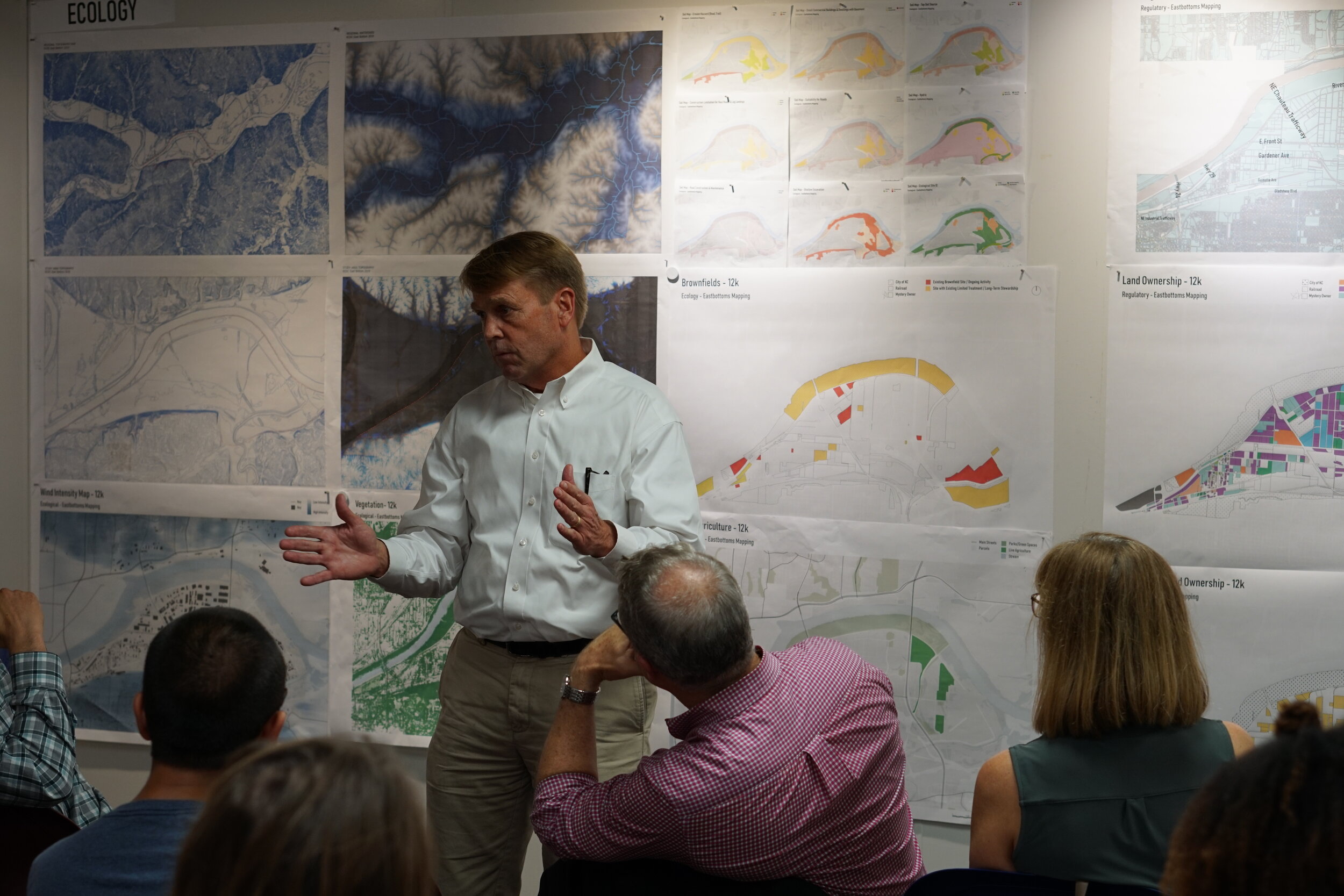
Our first advisory meeting was on September 11th, where we had the of sharing our findings with Joe Perry from PortKC, Tom Jacobs from MARC, Scott Brown from Faultless Starch, and Susan Brown from Platte Valley Bank. We received great feedback, information, and enthusiasm for the potential in this area.

Image+1.jpg

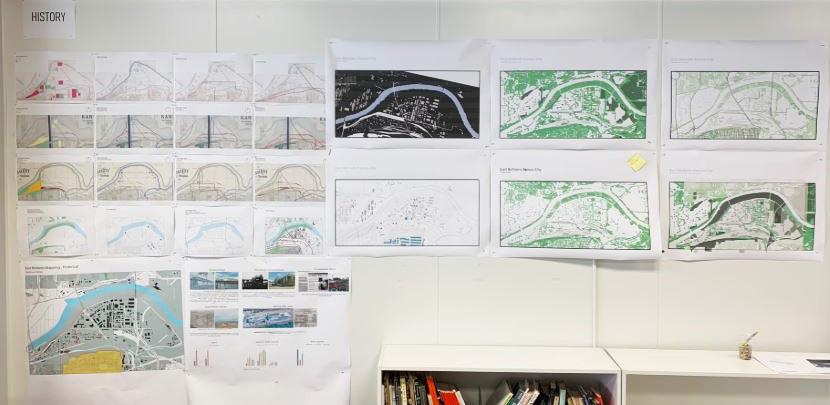
The studio began research by studying two main documents: The Riverfront Industrial Plan and the KC Blue Valley Plan. As we continue to inventory our research and data of this area, we have put our findings into five main categories: physical, history, demographics, transit/connections, ecological, and regulatory.

Physical elements— includes figure ground maps, parcel map studies, topography, and the creation of a new digital 3D model of the site.

History— includes how this area originally developed including over-time maps of railways and roads, the river, occupation density, and building type.

Demographics— includes information on the area’s race, age, schooling, and commuting statistics.

Transit/Connections— includes regional connections via rail and highways, local bus routes, bike and recreation trails, major connections/intersection points, dead-end streets, and high volume streets. We have also been looking into freight volume, ownership, and what is being transported to and from sites in the East Bottoms.

Ecological— includes vegetation, pervious vs. impervious land, levee placement, watersheds, brownfields, flood zones, current green infrastructure developments, noise and air pollution, and wind/sun studies.

Regulatory— includes zoning, land use, building use, land ownership, out of state ownership and incentives.

Land Ownership parcels

Land Ownership parcels

Topographic Sections 700’ apart

Topographic Sections 700’ apart

Findings

From our research, we are starting to discover the distinct characteristics, challenges, and geographic roots specific to the East Bottoms. The character of the site includes a strong industrial fabric, heavy rail use, and disconnected way-finding. We believe this area has great potential and we are interested in finding ways to link the major thoroughfares in and out of the East Bottoms that employees can utilize and that minimize industrial traffic, reclaiming spaces that are currently unusable. The resulting efforts would develop a ‘Kansas City’ urban design model that looks at abandoned spaces to be utilized as continuous public realm.

Lastly, our project is live on the website! Check out the project page here. We’ve got drone footage coming and will be updating our findings as we continue the project.

Meet Our New Executive Director
tc headshot B&W.jpg

The Kansas City Design Center is excited to welcome Terrance Clark as our new Executive Director. As Executive Director, Clark will draw on his extensive experience in the non-profit sector to provide leadership, creative and strategic planning, development, and implementation for the KCDC. “I look forward to every day being filled with community engagement and educational outreach to benefit the work and enhance the inherent value of creative individuals and organizations; and, meaningful collaborations with entrepreneurial innovators, artists, designers, new ventures, small creative businesses, and advancing local and regional partnerships,” Clark said.

Clark has served as Co-Founder and Executive Director of the non-profit design organization Thrive, located in the Arkansas/Mississippi Delta. Thrive initiates public-private partnerships for entrepreneurial training and art/design programming. His efforts and leadership have led to invitations to apply partner programs in two public high school districts for STEAM training, mentoring recent art college graduates and Americorps recruits; innovative design initiatives with regional private investors; and, attracting private philanthropy to the work addressing community development.

Please join us in welcoming Terrance to the KCDC leadership team, we are excited for this next phase in KCDC’s growth as a catalyst for positive change in the Kansas City region.

A New Year in the East Bottoms!

The 2019-2020 studio year has officially begun! This year we are working on a vision study for the East Bottoms area of Kansas City. Our studio group this year is made up of 12 students, all of us encountering the East Bottoms for the first time, even though many of us have lived here most of our lives. We are excited to explore the site and learn about the history of the East Bottoms area. For most of us, this is our first time working in groups, so we are excited to see how collaboration can help us explore the uses of urban planning in this setting.

DSC05948.JPG
DSC05952.JPG

We kicked off the project with a site visit to explore the conditions and opportunities in the area. We started at the southern border of the study area— Cliff Drive and Kessler Park. From here, we were able to see the dramatic landscape condition of the bluffs that seperates the East Bottoms from the residential area of Scarritt Renaissance. We then stopped at the newly opened J. Reiger & Co to see what amenities the East Bottoms has to offer. After touring the brewery and enjoying the spiral slide, we started to investigate how industrial/historic buildings could be renovated to allow people to interact with them. Locations like J.Reiger that act as destination spaces that not only manufacture goods but become a place where people can learn about the history of the area and how goods are created are an exciting precedent for the East Bottoms.

DSC05971.JPG
DSC05976.JPG
site visit 1.jpg
site visit 2.jpg

The group then began exploring different precedents that could improve the connection between Kansas City and the East Bottoms— including ideas like bringing the streetcar to the East Bottoms as an easy way to access that part of the city. We also examined projects that dealt with river fluctuations and how to bring more activities and programs to the Riverfront Park. We want to bring people closer to nature and figure out how to reconnect to the river despite the current levee system that cuts off resident’s access to the river.

DSC05985.jpg
site visit 3.jpg
DSC05996.jpg

After a day exploring the site and some precedent research, we split into three groups to analyze the history and physical and regulatory mapping of the area. Through our mapping studies we were able to see how the Missouri River has affected the East Bottoms over time and identify some of the historic buildings in the Area. We also mapped the foliage and topography of the site to examine the challenges that it may present in addition to identifying inventories of live agriculture, land use, zoning, and transportation. Next, we will explore the site on an expanded scale and see how it connects to the rest of the city. We will also locate some of the environmental factors of the site such as brownfields and research how other projects in the area have approached these challenges.

mapping 1.jpg
mapping 2.jpg

We’re excited to move forward and continue exploring the possibilities for the project. You can follow along via our social media (@kcdesigncenter) and public meetings later in the semester!