A New Year in the East Bottoms!
The 2019-2020 studio year has officially begun! This year we are working on a vision study for the East Bottoms area of Kansas City. Our studio group this year is made up of 12 students, all of us encountering the East Bottoms for the first time, even though many of us have lived here most of our lives. We are excited to explore the site and learn about the history of the East Bottoms area. For most of us, this is our first time working in groups, so we are excited to see how collaboration can help us explore the uses of urban planning in this setting.
We kicked off the project with a site visit to explore the conditions and opportunities in the area. We started at the southern border of the study area— Cliff Drive and Kessler Park. From here, we were able to see the dramatic landscape condition of the bluffs that seperates the East Bottoms from the residential area of Scarritt Renaissance. We then stopped at the newly opened J. Reiger & Co to see what amenities the East Bottoms has to offer. After touring the brewery and enjoying the spiral slide, we started to investigate how industrial/historic buildings could be renovated to allow people to interact with them. Locations like J.Reiger that act as destination spaces that not only manufacture goods but become a place where people can learn about the history of the area and how goods are created are an exciting precedent for the East Bottoms.
The group then began exploring different precedents that could improve the connection between Kansas City and the East Bottoms— including ideas like bringing the streetcar to the East Bottoms as an easy way to access that part of the city. We also examined projects that dealt with river fluctuations and how to bring more activities and programs to the Riverfront Park. We want to bring people closer to nature and figure out how to reconnect to the river despite the current levee system that cuts off resident’s access to the river.
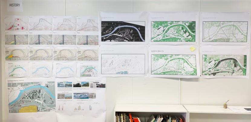
After a day exploring the site and some precedent research, we split into three groups to analyze the history and physical and regulatory mapping of the area. Through our mapping studies we were able to see how the Missouri River has affected the East Bottoms over time and identify some of the historic buildings in the Area. We also mapped the foliage and topography of the site to examine the challenges that it may present in addition to identifying inventories of live agriculture, land use, zoning, and transportation. Next, we will explore the site on an expanded scale and see how it connects to the rest of the city. We will also locate some of the environmental factors of the site such as brownfields and research how other projects in the area have approached these challenges.
We’re excited to move forward and continue exploring the possibilities for the project. You can follow along via our social media (@kcdesigncenter) and public meetings later in the semester!


