Abandoned Spaces→ Public Realm
Advisory Meeting #1
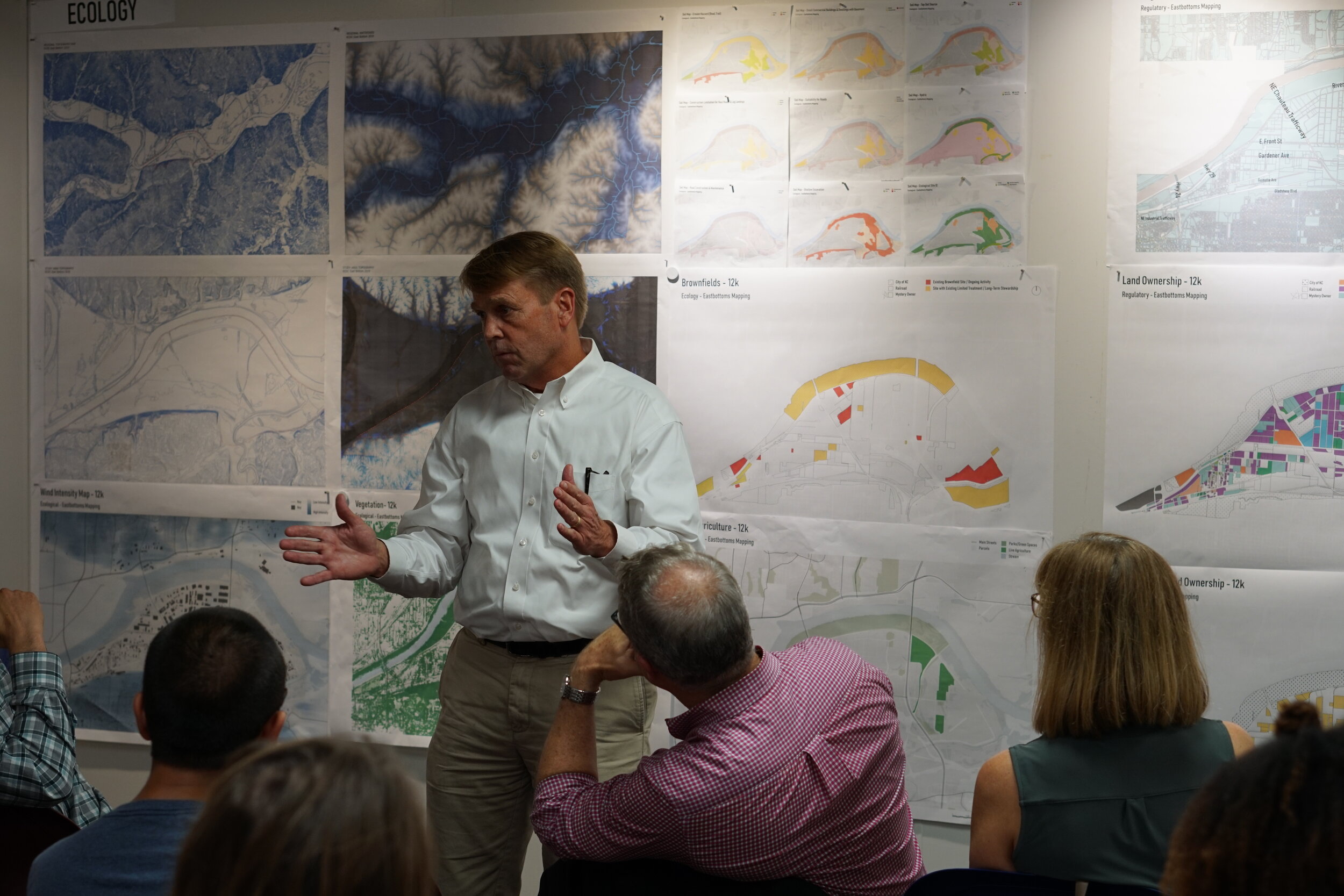
Our first advisory meeting was on September 11th, where we had the of sharing our findings with Joe Perry from PortKC, Tom Jacobs from MARC, Scott Brown from Faultless Starch, and Susan Brown from Platte Valley Bank. We received great feedback, information, and enthusiasm for the potential in this area.
The studio began research by studying two main documents: The Riverfront Industrial Plan and the KC Blue Valley Plan. As we continue to inventory our research and data of this area, we have put our findings into five main categories: physical, history, demographics, transit/connections, ecological, and regulatory.


Physical elements— includes figure ground maps, parcel map studies, topography, and the creation of a new digital 3D model of the site.
History— includes how this area originally developed including over-time maps of railways and roads, the river, occupation density, and building type.
Demographics— includes information on the area’s race, age, schooling, and commuting statistics.
Transit/Connections— includes regional connections via rail and highways, local bus routes, bike and recreation trails, major connections/intersection points, dead-end streets, and high volume streets. We have also been looking into freight volume, ownership, and what is being transported to and from sites in the East Bottoms.
Ecological— includes vegetation, pervious vs. impervious land, levee placement, watersheds, brownfields, flood zones, current green infrastructure developments, noise and air pollution, and wind/sun studies.
Regulatory— includes zoning, land use, building use, land ownership, out of state ownership and incentives.
Land Ownership parcels
Topographic Sections 700’ apart
Findings
From our research, we are starting to discover the distinct characteristics, challenges, and geographic roots specific to the East Bottoms. The character of the site includes a strong industrial fabric, heavy rail use, and disconnected way-finding. We believe this area has great potential and we are interested in finding ways to link the major thoroughfares in and out of the East Bottoms that employees can utilize and that minimize industrial traffic, reclaiming spaces that are currently unusable. The resulting efforts would develop a ‘Kansas City’ urban design model that looks at abandoned spaces to be utilized as continuous public realm.
Lastly, our project is live on the website! Check out the project page here. We’ve got drone footage coming and will be updating our findings as we continue the project.


